
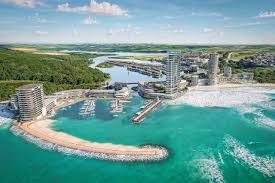
Marina Development
Marina Development
Buffalo City · Eastern Cape
R0 to R10 — documentation only, not an investment score
R0Concept
- 1
R1Site Identified
- 2
R2Site Verified
- 3
R3Pre-Feasibility
- 4
R4Approvals Underway
- 5
R5Feasibility
- 6
R6Commercially Validated
- 7
R7Bankable
- 8
R8Funding
- 9
R9Financial Close
- 10
R10Construction / Operational
VerifiedEvidence uploaded, awaiting verificationNext milestone
Marina Development · 29 steps across 6 processes · typical preparation 18–36 months
Next de-risking milestone
Concept → site verified
From R0 Concept to R2 Site Verified · project is at R0
Required work
- •Location mapping
- •Tenure screening opinion
- •Inside-port or open-coast route
- •DFFE screening report
Gates still to close for this milestone
- !Location identified and mapped — Land / hydrographic surveyor (SAGC); coastal engineer
- !Tenure of the water and land screened — Environmental / property attorney
- !Inside-port or open-coast regulatory route decided — Ports / maritime attorney
- !DFFE environmental screening report generated — EAP (EAPASA)
Programme
about 2–3 months
Preparation capital (this milestone)
Not yet stated
Legal and data fees
People to appoint
Coastal / property attorney · EAP · Surveyor
An investor is asked to fund this specific step — not the whole project. Development capital de-risks; construction capital builds.
29 needed · 0 in progress. Change a step on the right. Request a study when a professional has to do the work.
Marine site & coastal engineering
0 of 6 steps on file · 25% of the documentation score
Verified is set by InfraPlan after review
Evidence required
Water-area polygon and landward erven / farm portions with SG codes, high-water mark position, nearest port limits, estuary or river mouth, marine protected area boundaries, existing slipways / harbours, dated photographs
Authority / who signs it off
Chief Surveyor-General (cadastre); SANHO charts; DFFE (MPA boundaries); TNPA (port limits)
Where
CSG Property Viewer; SANHO nautical charts; DFFE marine protected area maps; TNPA port limits on the port legal framework page
Who to contact and how
Provincial Surveyor-General; SANHO (sanho.co.za); TNPA port manager's office
Professional needed
Land / hydrographic surveyor (SAGC); coastal engineer
Indicative duration
1–3 weeks
Responsible party
Developer / sponsor
Evidence vault · 0 documents
Owner
Owner role
Due
Note / current position
Verified is set by InfraPlan after review
Verified is set by InfraPlan after review
Verified is set by InfraPlan after review
Verified is set by InfraPlan after review
Verified is set by InfraPlan after review
This score is documentation only. It records what is on file and verified — not whether the project is a good investment.
Next upload
SARS tax compliance (TCS PIN)
One file. The rest wait. Needed for this seat.
Project details
Click the map to pin the site, or draw the project area
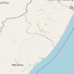
Pin the site or draw the area this project will sit on.
Files on this project
No files on your access level yet.
People on this process
The platform suggests who usually sits on each side. Attach them, then limit what they can see.
No one attached yet. Add a suggestion below.
Letters
Use a template, write on the system, then sign. Each signature records who signed and how.
No letters on your access level yet.
Manage